PLATFORM
Historical maps of Europe, 1934–1945
The historical maps show changes in political borders, territorial expansion, occupations and the development of systems of persecution in Europe during the 1930s and 1940s. They provide a spatial perspective on the connections between Nazi, Fascist and other far-right regimes, and on the historical processes that led to mass violations of human rights, the Holocaust and other crimes during the Second World War.
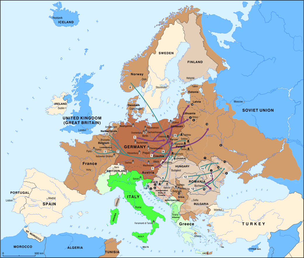
The map shows the situation up to November 1942, the peak of the territorial expansion of the Third Reich and Fascist Italy. The Nazis and their allies were carrying out the so-called ‘Final Solution’, the systematic destruction of European Jews, through mass killings, internment in Jewish ghettos, and organized deportations from occupied and dependent countries to concentration camps and extermination camps. Victims of persecution, deportation, and mass murder also included Roma, members of Slavic peoples, persons with disabilities, prisoners of war, and numerous political opponents.
Legend