PLATFORM
Historical maps of Europe, 1934–1945
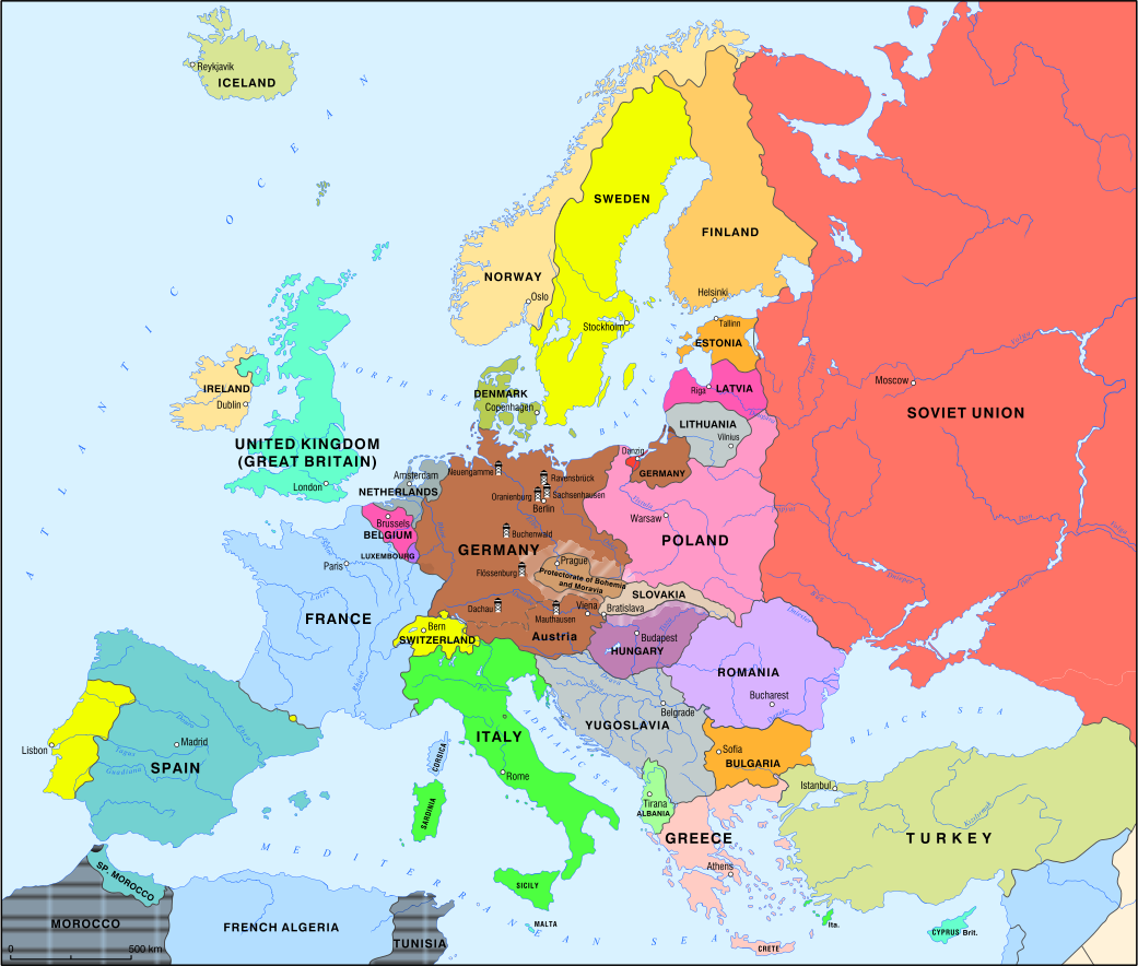
The historical maps show changes in political borders, territorial expansion, occupations and the development of systems of persecution in Europe during the 1930s and 1940s. They provide a spatial perspective on the connections between Nazi, Fascist and other far-right regimes, and on the historical processes that led to mass violations of human rights, the Holocaust and other crimes during the Second World War.
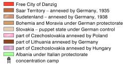
By May 1939, the expansion of Nazi Germany and Fascist Italy had already altered Europe's borders. Parts of the territories of several states had been annexed by the Third Reich and its allies, while puppet regimes had also been established. The network of concentration camps was expanding into newly annexed territories.
Legend