PLATFORM
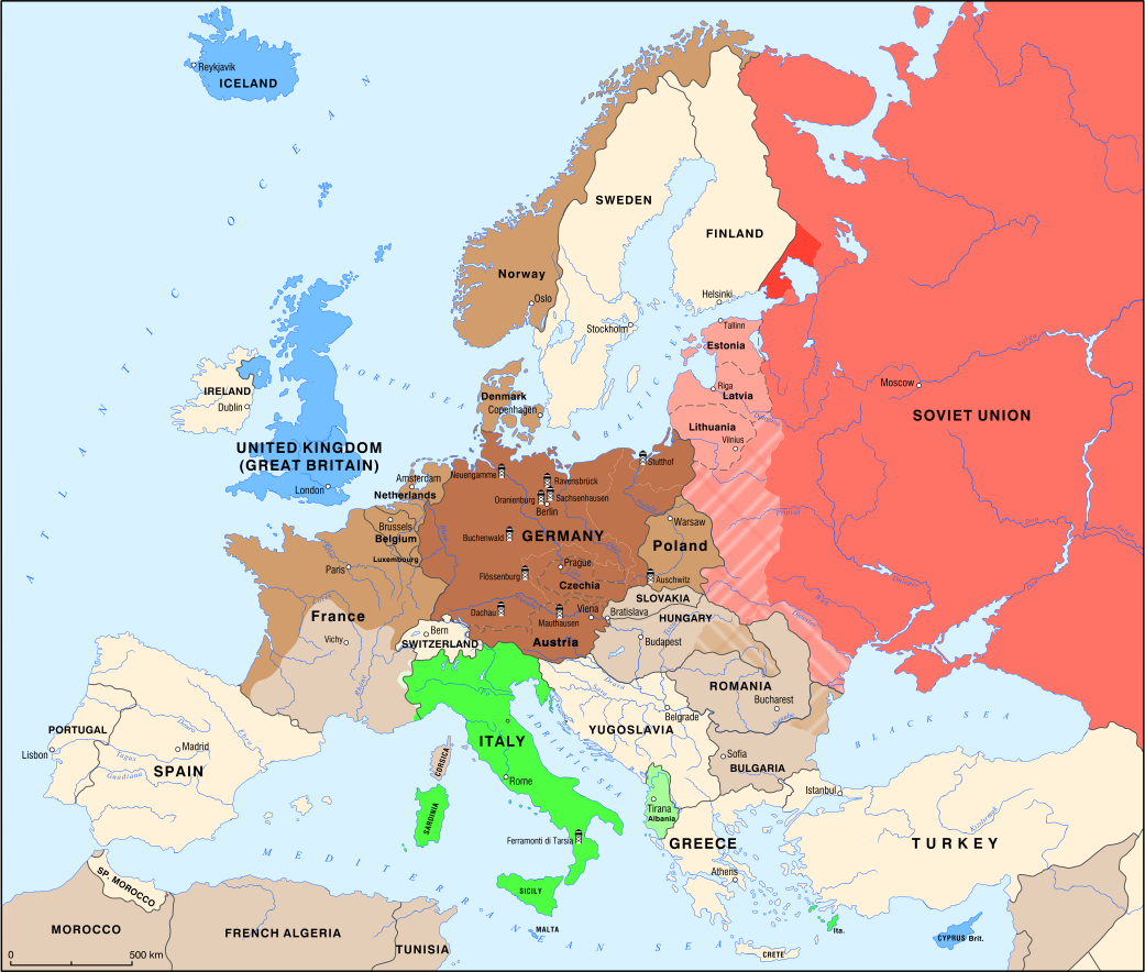
Historical maps of Europe, 1934–1945
The historical maps show changes in political borders, territorial expansion, occupations and the development of systems of persecution in Europe during the 1930s and 1940s. They provide a spatial perspective on the connections between Nazi, Fascist and other far-right regimes, and on the historical processes that led to mass violations of human rights, the Holocaust and other crimes during the Second World War.
By November 1940, after more than a year of warfare, the Third Reich had invaded and occupied territories of numerous countries, while the nations of southeastern Europe joined the Axis Powers. At the same time, the Soviet Union annexed the Baltic states and parts of Eastern Europe. The Nazi regime expanded its network of concentration camps eastward, including the opening of Auschwitz.
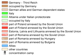
Legend